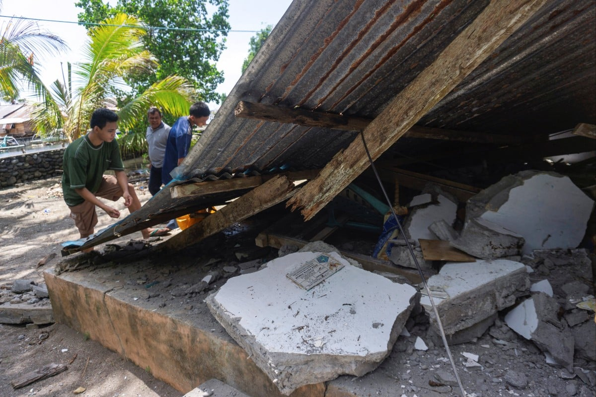
The tremor, which triggered tsunami warnings along the southern coast, left collapsed buildings, damaged homes and debris-strewn streets in its wake. At least 32 people were killed and more than 130 injured, with scores still missing, local disaster authorities said.
For disaster planners, the destruction offered a glimpse of the stakes for the capital. Metro Manila sits along the West Valley Fault, a major fault running about 100km through the eastern city and neighbouring provinces. Scientists say it could produce a magnitude 7.2 earthquake – the so-called Big One – based on its size and past activity, with the last major rupture believed to have occurred in the mid-1600s.
Because the fault runs directly beneath densely populated areas, a 7.2 quake here could cause far more severe damage to buildings, infrastructure and lives than even a larger offshore earthquake, such as Monday’s 7.8 tremor.
The collapsed buildings seen in Mindanao are only a small preview of what could happen should a similar earthquake hit Metro Manila, according to Rene “Butch” Meily, president of the Philippine Disaster Resilience Foundation, the country’s main private-sector coordinator for disaster risk reduction.
“And this happened right when people were at school or eating breakfast. My heart goes out to all the people there. I’m glad if many of them were outside the buildings. But it just underscores the danger to a city like Metro Manila that on an ordinary day is hard to move around,” Meily said.
“With the most densely populated city in the world, I think it’s very important that we continue to prepare and that we get ready for the Big One.”
Meily said residents were more aware than before, with many practising “duck, cover and hold”, but warned that the threat of a major earthquake was “the one thing that keeps me up at night”.
“Because no matter where you live, especially in Metro Manila … you have to wonder … how safe you’re gonna be,” he said.
He advised families to have emergency plans, go bags and designated meeting points, noting that communications could fail during a large quake.
He also warned that Manila’s limited evacuation routes – primarily north-south roads and potentially complicated sea routes – would make rapid, orderly evacuation a major challenge, requiring coordination from government, businesses and civil society.
‘It was frightening’
Scenes from Mindanao on Monday offered a glimpse of what the Big One might look like and how the country would respond.
Minutes after the quake struck at 7.37am local time, videos circulating online showed a Jollibee restaurant in one of the worst-hit cities partially collapsed. Emergency workers called for anyone trapped to respond by knocking or tapping on debris.
Nearby, students at Matanao High School in Davao del Sur screamed and rushed to an open field as the ground shook during a flag-raising ceremony.
A government worker, Shennilane Sapilo, told This Week in Asia she was at the bus terminal heading to the office when the earthquake hit.
“The bus swayed from side to side and it was frightening. Everyone around me looked worried because the shaking was quite strong,” Sapilo said.
Tsunami waves battered coastal areas of Mindanao, with the highest measured at 1.4 metres above normal tide levels. Officials urged residents to move to higher ground and remain vigilant for aftershocks.
Dr Teresito Bacolcol, director of the Philippine Institute of Volcanology and Seismology (PHIVOLCS), told reporters the quake was expected to trigger structural damage and aftershocks.
“People in coastal areas are strongly advised to evacuate to higher ground,” he said.
Winchelle Ian Sevilla, PHIVOLCS’ seismology division chief, said the tremor was caused by movement along the Cotabato Trench, the same tectonic feature behind the devastating 1976 Moro Gulf earthquake that killed thousands and generated a tsunami along Mindanao’s coast.
President Ferdinand Marcos Jnr ordered an immediate government response, suspending classes in affected areas and directing agencies to preposition relief goods and prepare evacuation centres.
“To our kababayans [fellow Filipinos] in the affected provinces, please heed the tsunami warning. Move to higher ground now. Do not wait. Your life is more important than anything left behind,” Marcos said.
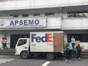
Military personnel were deployed to support search-and-rescue operations, clear affected roads and provide humanitarian help.
Major General Alvin Luzon, commander of the 10th Infantry Division said troops were already involved in disaster response and rescue operations.
Philippine Red Cross chairman Richard Gordon confirmed teams were assessing affected areas and supporting communities with medical readiness and structural safety.
Preparedness for the Big One
The Mindanao earthquake also highlighted why preparations for a major Metro Manila quake remain critical. Experts said the destruction offered a real-world reminder of how a densely populated urban area could be affected.
“That’s why we set up an operations centre in Clark,” Meily said, referring to the former US airbase north of Manila that had become a major logistics and aviation hub. “If something happens in Manila, a separate team in Clark can continue to operate and expedite response measures.”
Meily also noted the strategic importance of nearby logistics hubs.
“The Clark Airport and the Port of Subic are two critical logistics gateways. In the event of a major disaster, much of the incoming aid and help would likely flow through those areas,” he said, explaining that their location and capacity could make them key hubs for disaster relief.
The Mindanao quake comes as the Philippines and international partners are already running large-scale disaster-response exercises to prepare for a major Metro Manila earthquake, testing coordination, logistics and rapid response across government, military and civilian agencies.
The Tempest Express Exercise, which runs until Wednesday in Pasay City, brought together military planners and disaster-response experts from 31 countries under the US-backed Multinational Planning Augmentation Team.
“This is simply not a military exercise per se,” Joe Althouse, director of the Exercise Control Group at US Indo-Pacific Command, told reporters. “Although the military will be quite often first responders to help in times of crisis, it’s ultimately a civilian-led response.”
Althouse said the aim was to put disaster management in the hands of civilian leaders as quickly as possible, providing them with enough information to guide the response effectively.
The Philippines lies along the Pacific Ring of Fire, where shifting tectonic plates make earthquakes frequent, and has suffered repeated destructive quakes in recent years.
In September last year, a magnitude 6.9 earthquake struck off Cebu province, killing at least 79 people, while a magnitude 7.6 quake off Mindanao in December 2023 triggered tsunami warnings and caused damage in the south, leaving three people dead and 79 others injured.
A magnitude 7.0 earthquake struck northern Luzon in July 2022, killing at least 11 people.
One of the country’s deadliest modern earthquakes struck northern and central Luzon in 1990. A magnitude 7.8 tremor caused severe damage in Baguio and other cities, killing at least 1,600 people.
Article by Jeoffrey Maitem | South China Morning Post
Photo by South China Morning Post